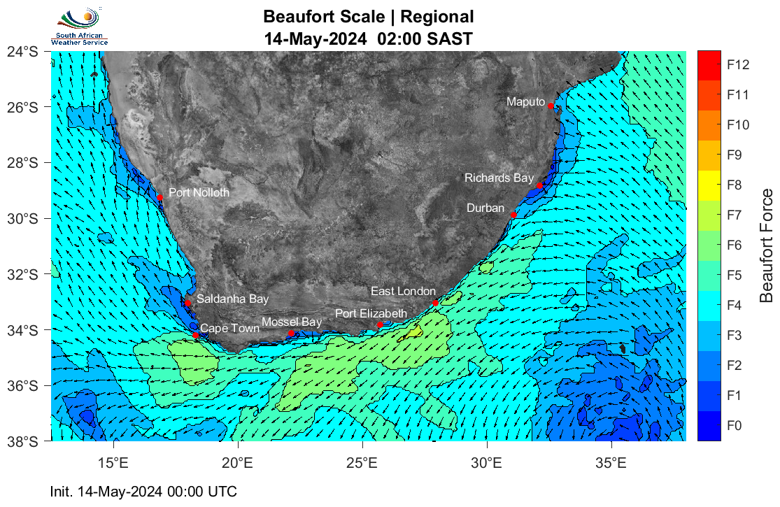
The Beaufort Scale is a simple way of describing wind strength and sea conditions using numbered levels, ranging from calm conditions to storm-force winds. Instead of focusing on technical wind speeds,
it explains what the weather will look and feel like at sea, such as how rough the waves are and how challenging conditions may be for vessels.
This scale is commonly used by mariners, including fishermen, small boat operators, and sailors, because it links wind strength directly to observable sea conditions. For example, it can indicate whether
the sea will be smooth with small ripples, or rough with large waves and spray.
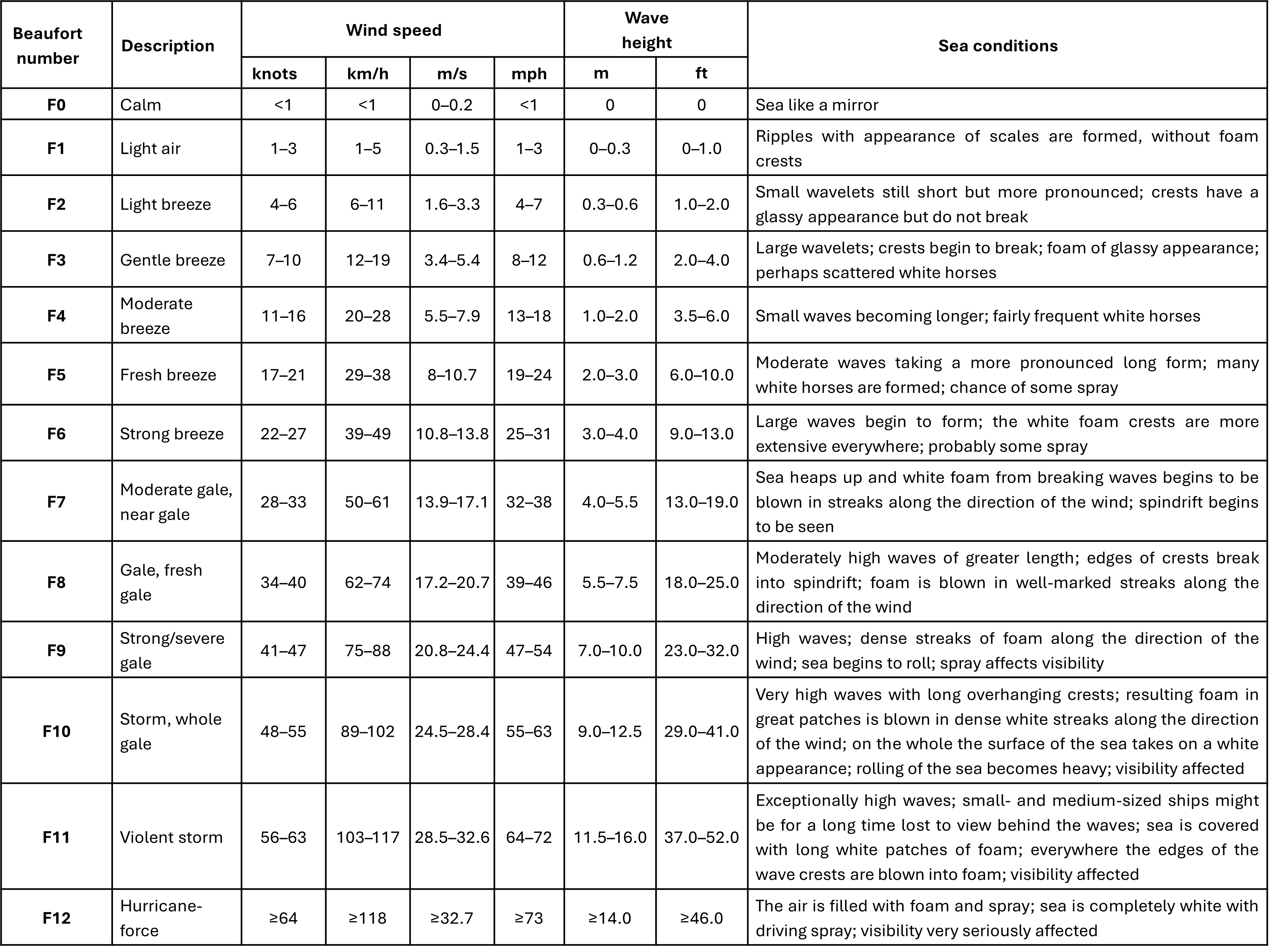
The forecast is presented using the Beaufort Scale to help users quickly assess expected sea conditions. The table explains each Beaufort force level, what conditions are typically experienced,
and how they may affect activities at sea.
The table below explains each Beaufort force level, describing the typical sea conditions and potential impacts on activities at sea. It can be used alongside the map to help interpret the force levels
displayed.
This Beaufort Scale forecast is also provided for key coastal locations listed below.
This Beaufort Scale forecast is also provided for key coastal locations listed below.