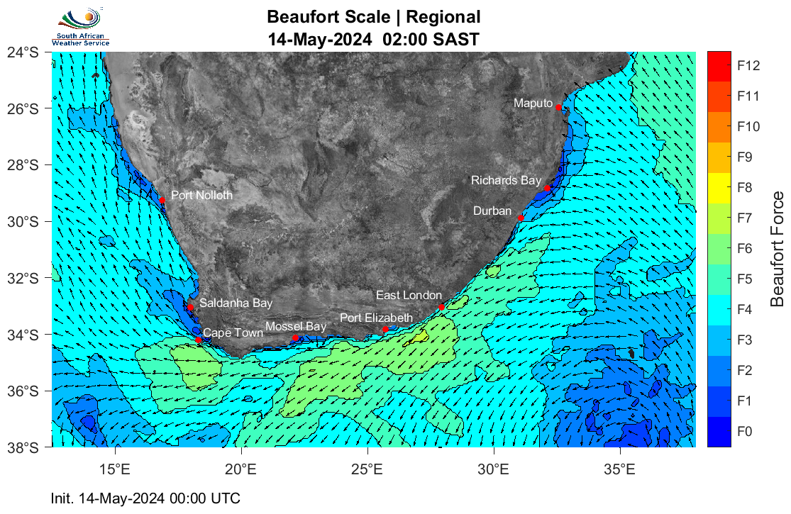
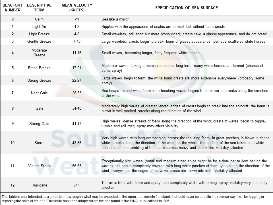
The condition of the ocean surface is the result of the combined effects of various marine weather parameters acting on it concurrently. To paint a clearer picture of the ocean surface likely to be produced by a particular set of parameters, various scales have been developed. One such scale is the Beaufort Scale, which provides the likely state of the ocean surface in response to particular wind conditions. The Beaufort Scale has been used for centuries and, in its updated form, is still used extensively by mariners globally thanks to its ability to link wind conditions to ocean response more intuitively. It may not be as well known to coastal or recreational users but can be helpful in visualising what the ocean might look like for a given forecast.
The forecast maps available below show the forecast Beaufort Force. The high-resolution maps are accompanied by a photograph depicting the expected ocean surface character according to the dominant Beaufort Force for that particular map and time. Whilst the imagery is standard in the marine community, they remain estimates only, and actual conditions may vary.