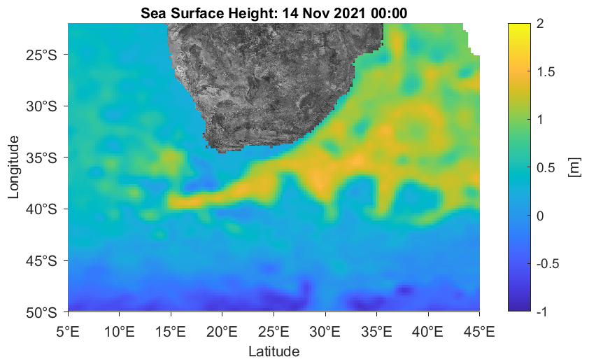
Sea surface height (or absolute dynamic topography) is a useful measure of the level of the sea surface in relation to a reference level. It provides
a useful proxy for the strength of surface currents. Take a look along the east coast of South Africa, where an considerable elevation is normally present
due to the strong, south-westward flowing Agulhas Current.
The data presented here are courtesy of the E.U. Copernicus Marine Service. They represent a fusion of altimetry data
from Jason-3, Sentinel-3A, HY-2A, Saral/AltiKa, Cryosat-2, Jason-2, Jason-1, T/P, ENVISAT, GFO, ERS1/2. Please see the
Copernicus product page for more information.