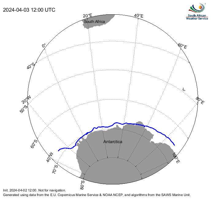
In the interests of maritime safety, SAWS uses a combination of satellite and numerical models to produce an estimate of position of the sea ice edge in METAREA VII. At short time scales, the position of the sea ice edge is largely dependent on winds and ocean currents.
The automated daily sea ice edge position is estimated by applying forecast wind and current information to the most recent satellite-derived sea ice data, in order to offset the delay in satellite data availability. Today's edge and a 24-hour forecast are available as KML files. The information is updated at approximately 09h45 UTC each day. For details about the algorithm used to update the satellite derived sea ice edge, please refer to the publication Evaluating numerical and free-drift forecasts of sea ice drift during a Southern Ocean research expedition: An operational perspective.
This product is currently in the testing and evaluation phase and should not be used for navigation. It will ultimately be incorporated into the SAWS maritime safety information offering.