Rip currents are one of the leading causes of coastal drownings in South Africa, posing a serious risk to beachgoers.
These powerful, fast-moving channels of water flow quickly away from the shore, often identifiable by the way they disrupt the pattern of breaking waves.
Monitoring and predicting ocean waves is a primary activity within the SAWS Marine Unit.
Waves have an impact on every aspect of ocean and coastal activity and ecology, and have a particularly important impact on marine safety.
It's essential for beachgoers to understand how to recognize and avoid rip currents.
Look for signs such as water moving away from the shore faster than the surrounding areas.
Beach safety efforts, including education campaigns led by lifeguards and coastal safety officials, aim to raise awareness of these hazards and encourage safe practices.
To stay safe, always swim at beaches with lifeguards, follow safety guidelines, and use designated swimming areas marked by flags.
Avoid swimming in areas without lifeguard supervision, and be mindful of rip current forecasts, as these hazards are closely linked to wave and tide conditions.
A Rip Current Hazard Forecast System plays a crucial role in improving beach safety by providing forecasts of rip current activity.
With this system, beachgoers can make better-informed decisions, while lifeguards and beach safety teams can better prepare and respond to potential risks.
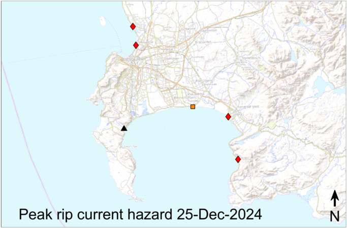
The forecast maps below show the Rip Current Hazard forecast for the Cape Peninsula coastline of South Africa.
The rip current forecasts are only avialable where the coloured symbols are shown. Rip currents can occur elsewhere!


