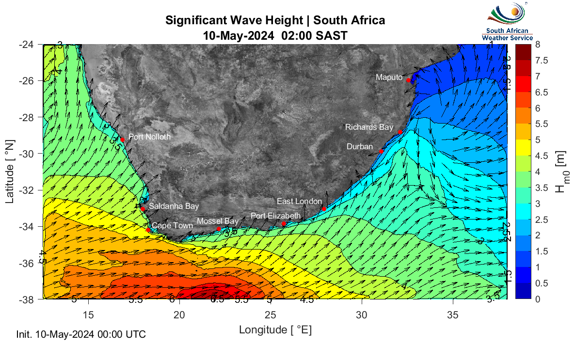
Monitoring and predicting ocean waves is a primary activity within the SAWS Marine Unit. Waves have an impact on every aspect of ocean and coastal activity and ecology, and have a particularly important impact on marine safety.
These data are produced in-house by the high resolution SAWS wave forecasting system. A nested modelling approach has been followed, where a local numerical grid has been nested, online, in the non-stationary regional spectral wave model. The map provides a regional overview (1⁄16 °, approximately 6 km), whilst the high resolution forecast maps (1⁄48 °, approximately 2 km) and time series plots below provide detail for specific areas of interest. The Marine Unit constantly monitors the performance of the wave model using observed data.
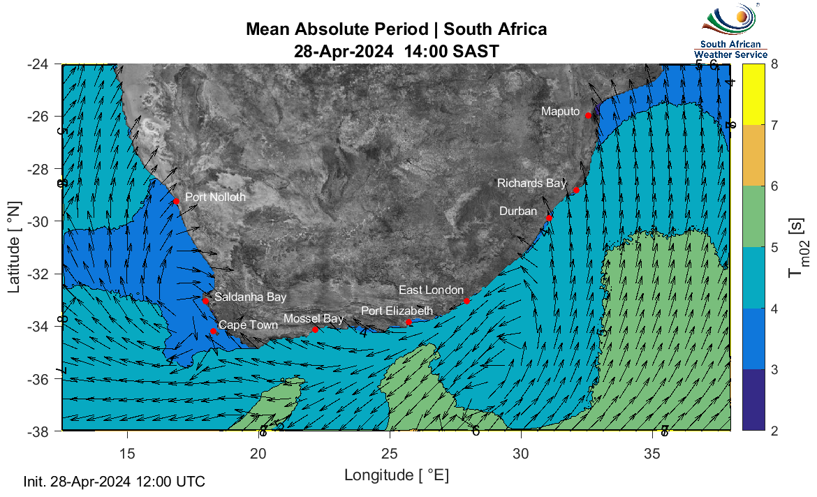
These regional and high resolution (zoomed-in) maps show the Mean Absolute Wave Period (Tm02). Wave period is an intrinsic property of a wave and will thus not readily change through shallow/intermediate water wave transformation. Thus Tm02 is used nearshore as an added parameter to better represent a user's experience of the local sea-state. It gives a useful idea of the average period of all the waves, rather than that of only the highest energy waves (peak period) in the area at that time (which is typically shown on time series graphs). See the following publication for more details: Waves in Oceanic and Coastal Waters - Leo Holthuijsen